High-precision GPS
Three GPS modes to choose between maximum precision or battery saving. Real-time signal quality indicator. Switch modes during an activity without interrupting recording.
GPS · Indoor and outdoor · Android and iOS
The ideal app for your adventures. High-precision GPS tracking, heart rate monitor, offline maps and real-time stats. No subscriptions, no ads, no accounts. All your data stays on your phone.
Screenshots are in English. The app is available in English, Spanish and Portuguese.
How it works
No accounts, no setup labyrinths. Open the app and you're recording.
Download from Google Play and open. No account, no email, no setup wizard.
Outdoor and indoor activities, each with its own metrics. Pair sensors if you have them.
Long-press start, the countdown does the rest. Auto-pause when you stop, even in live sharing.
Interactive charts, segments and history. Sync to Strava, Garmin and MisRutas.net or export in GPX/FIT/TCX.
01Record
Hold the button, the countdown runs and the recording begins. The app pauses by itself when you stop, reads your numbers out loud and keeps your sensors connected.
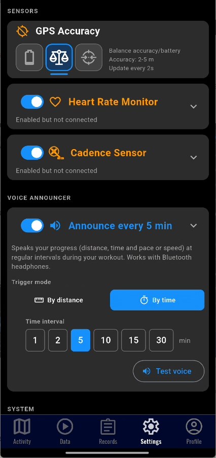
Three GPS modes to choose between maximum precision or battery saving. Real-time signal quality indicator. Switch modes during an activity without interrupting recording.
The app automatically detects when you stop and pauses the timer for all sports and also during live sharing. Stopped time doesn't count.
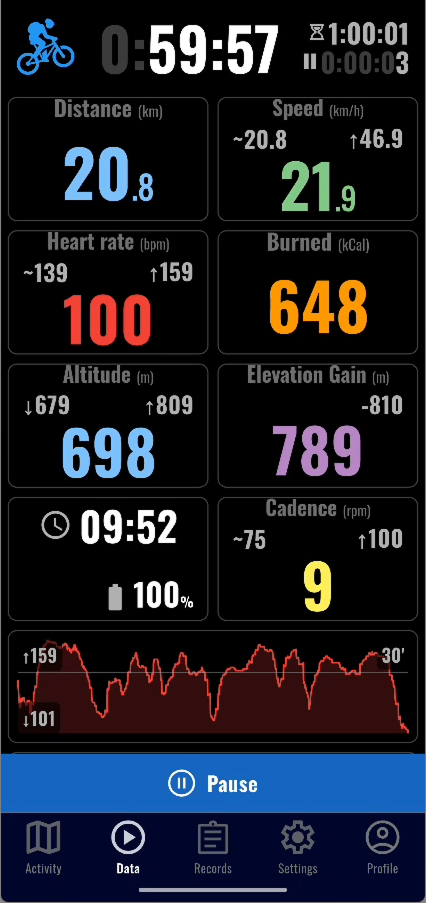
Distance, speed, pace, elevation, heart rate, cadence, calories, temperature and times. In running and treadmill activities, pace is shown automatically instead of speed. All in real time during the activity and in history. Maximum speed is measured as the speed sustained for ten seconds — also in imported routes — so a single GPS jump doesn't inflate it.
Every set distance or time the app reads out your total distance, time and pace or speed (average and last interval). Works with Bluetooth headphones, ducks external music and plays with the screen locked. While recording you can mute and unmute it with one tap from the map. Per-sport configuration, available in English, Spanish and Portuguese.
Before recording, the sport and the start button sit under a block showing your sensors live: whether they are searching or connected and the value they are reading right now. If the sport supports sensors you are not using, a line reminds you — tap it and you connect the sensor right there.
Connect any Bluetooth heart rate monitor. Auto-reconnect, interactive charts in 4 time ranges, training zones and full statistics. Affordable arm band monitors around €20-25 like XOSS Beat Band Pro or Coospo HW9 work great.
02Maps
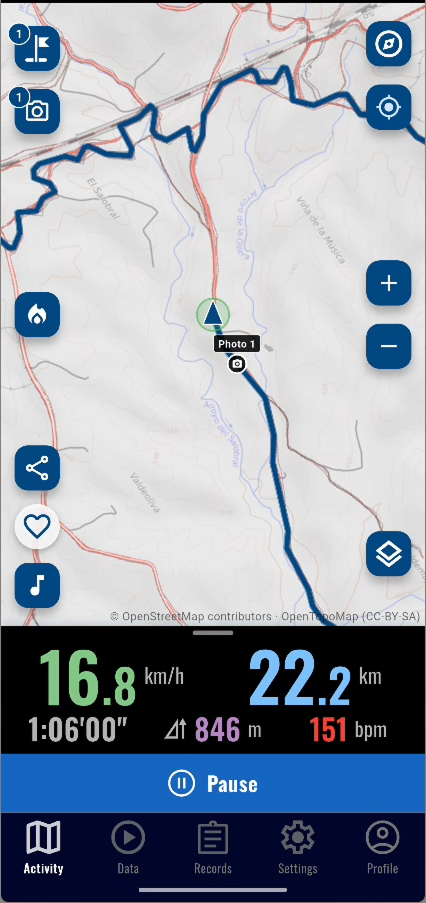
Five maps and a no-map mode. Switch from one to another in two taps, even while recording, and download the ones you need before you lose coverage.
Tap a map to see it
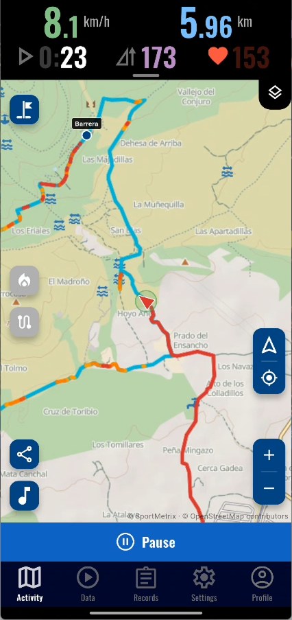
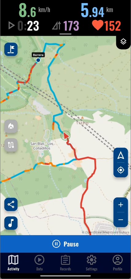
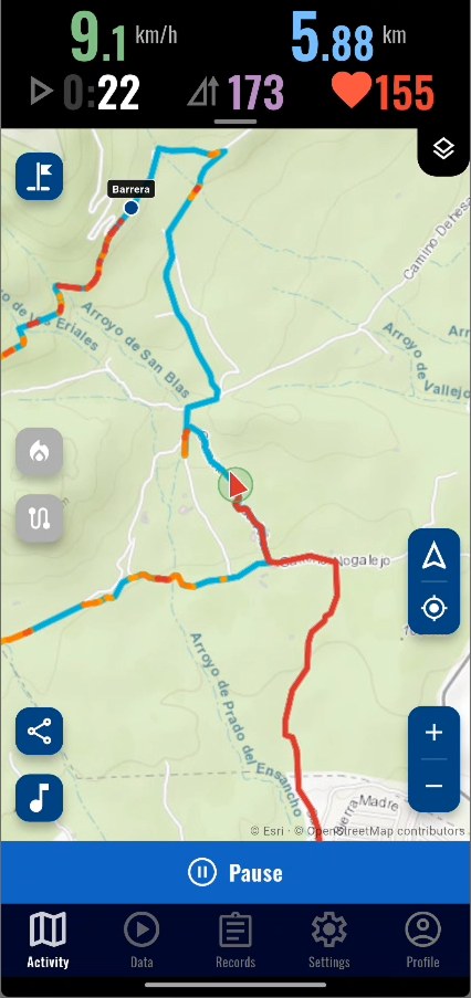
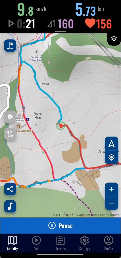
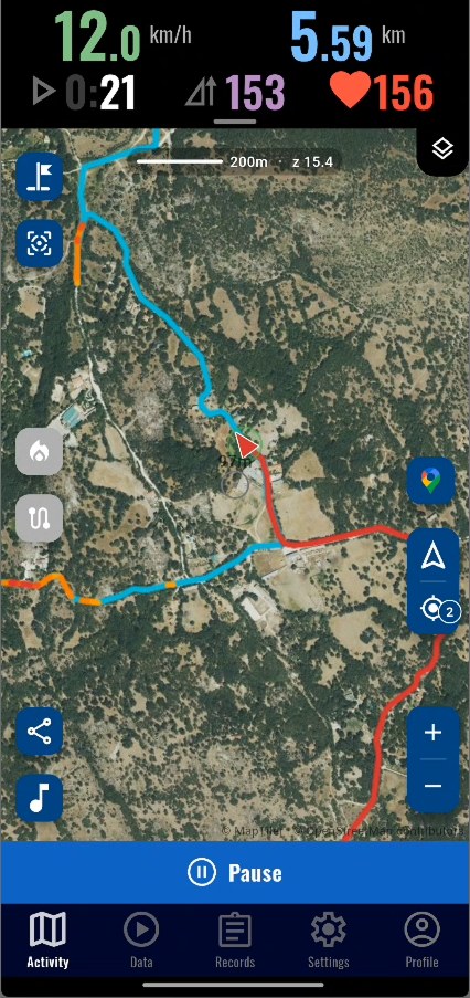
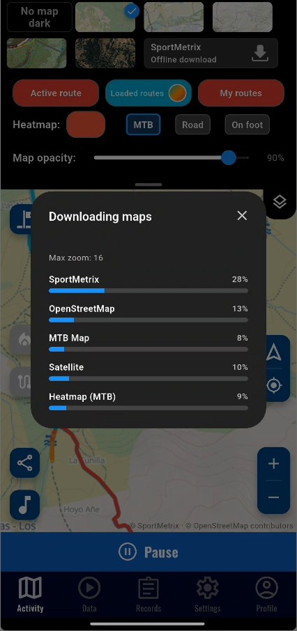
Our own map, built for the outdoors, showing what other maps leave out: caves, springs, water crossings, bivouac spots and plenty more information hikers rely on. Paths, tracks and service roads are told apart at a glance, and the detail grows as you zoom in. Available worldwide and downloadable to use without coverage.
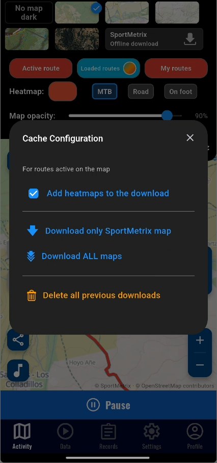
Download the maps with one click before heading out and use them without internet: the SportMetrix map, OpenStreetMap, MTB Map with contour lines and trails, and satellite. You can also view the Topo HD topographic map while you have coverage.
Even when you're not recording, the map can follow you and rotate based on your actual direction of movement in any outdoor sport. Handy for orienting yourself on a loaded route without starting a recording.
03Layers
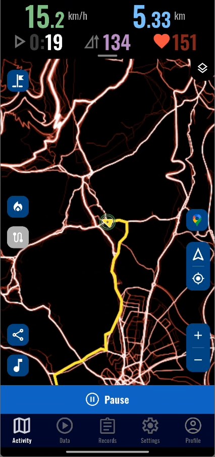
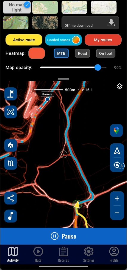
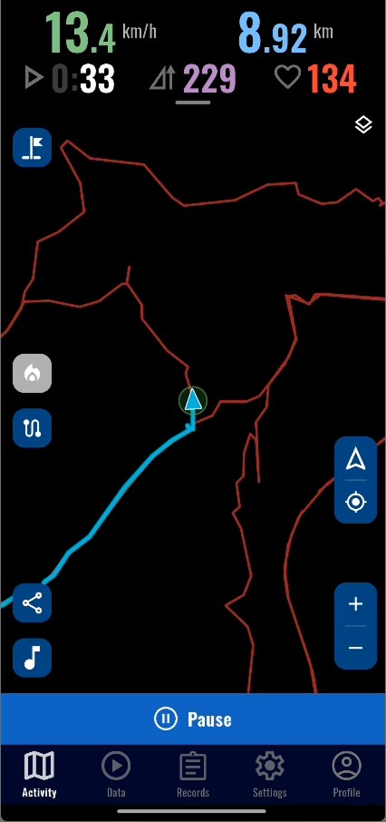
Two background layers over any map. The heatmap shows the most travelled paths; “My routes” shows the ones you have saved. Together they tell you which way is new.
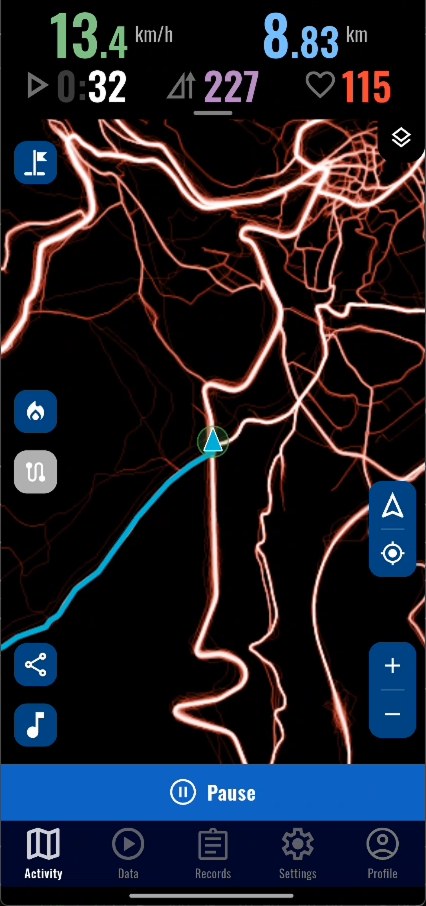
A heat layer on the map showing the most travelled paths, in the colour of your choice. Pick the sport (MTB, road or on foot) and toggle it with a floating button when there's data nearby. Worldwide coverage and also available in the route explorer. And when you download maps to go offline, you can add the area heatmap to the download.
Turn on "My routes" with one button and the map shows, in the background, every route you have saved that passes through the area you are looking at. You see at a glance where you have already been and can pick a different way. Only what falls on screen is drawn, so it stays smooth even with hundreds of routes. Combine it with the heatmap: one shows where everyone goes, the other where you have been.
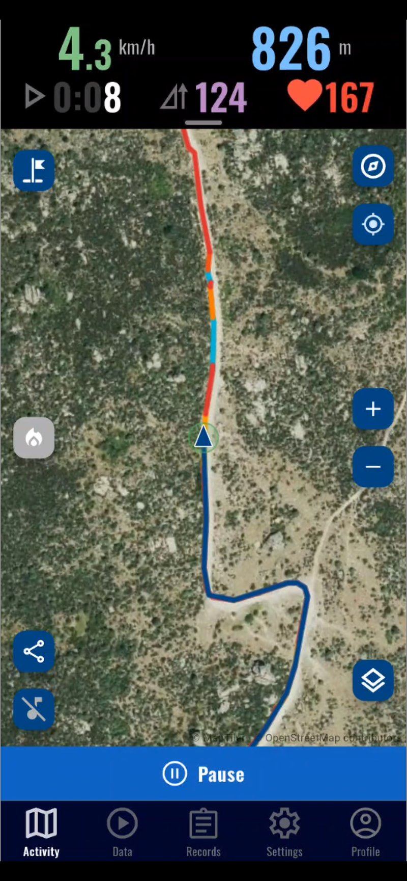
On the map, in the history thumbnails and in the route explorer, climbs are painted with an orange-to-red gradient in four slope bands (2-4%, 4-6%, 6-8% and over 8%). On out-and-back routes along the same path, the steeper section always stays on top so the descent never hides the climb. Handy to anticipate the terrain while following a reference route or to spot the profile of an activity at a glance.
04Waypoints
A spring, a broken bridge, a view worth coming back to. One button on the map saves it as text, photo or voice note, pinned to the exact spot.
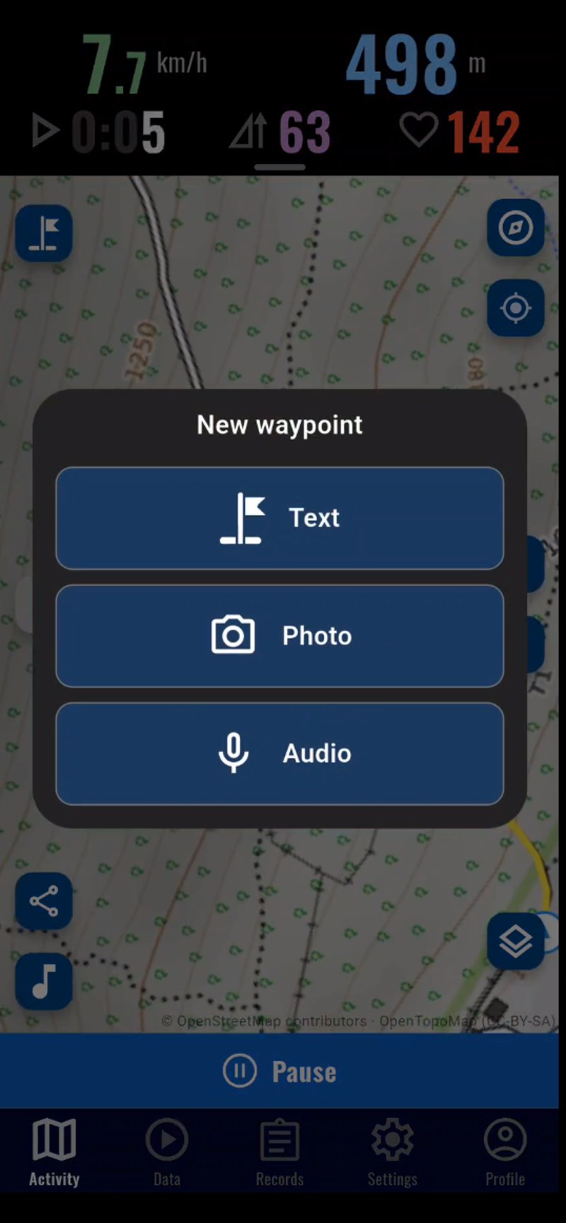
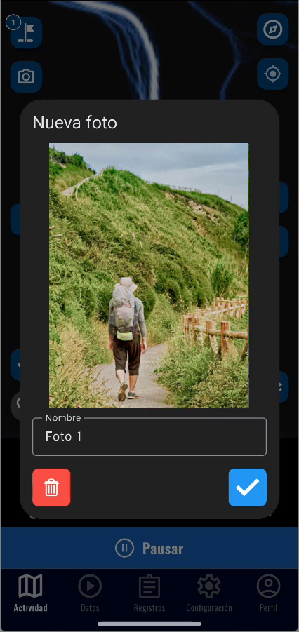
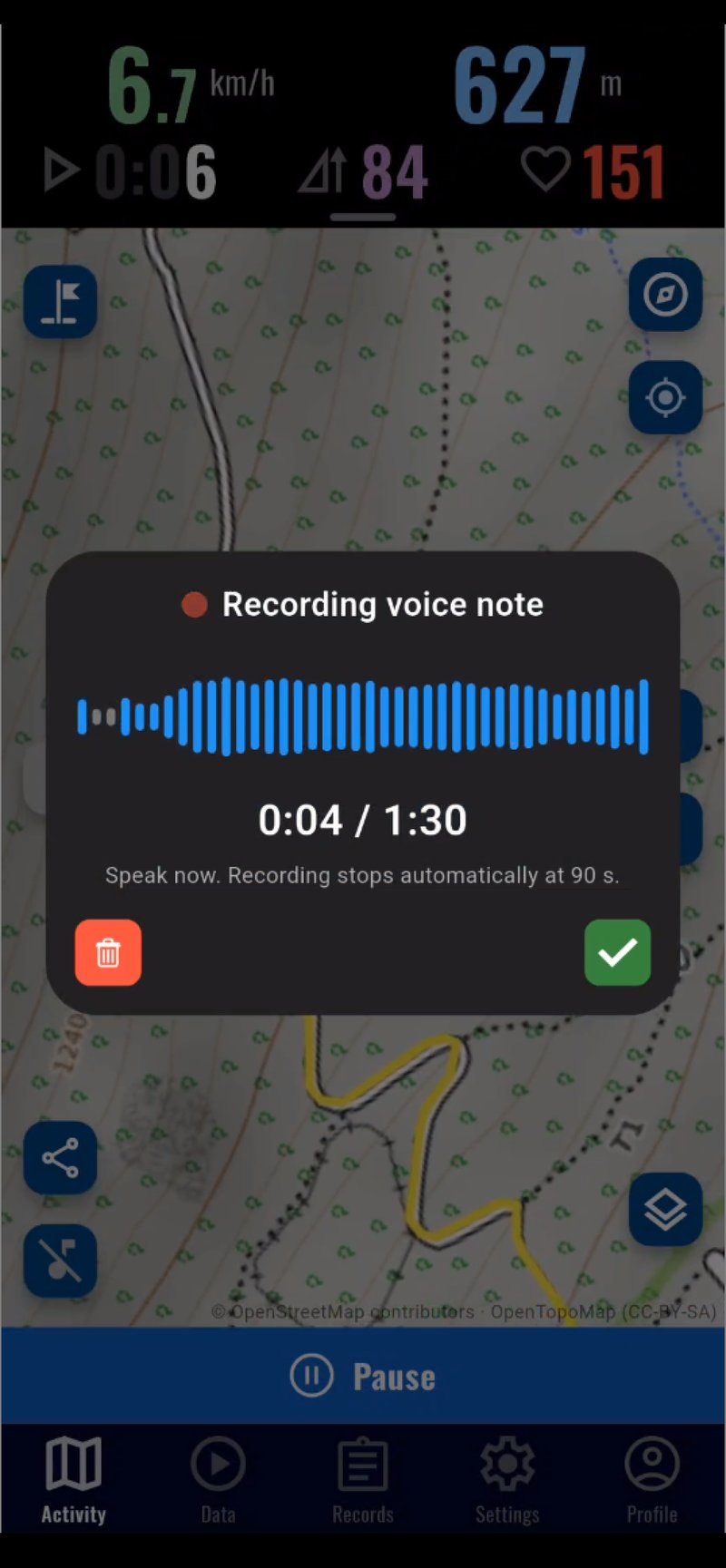
A camera button on the map while you record: each photo is pinned as a waypoint at the exact spot where you took it. Review them later in a full-screen viewer with zoom, keep a copy in your gallery and pick up to three to go with the route when you upload it to MisRutas.
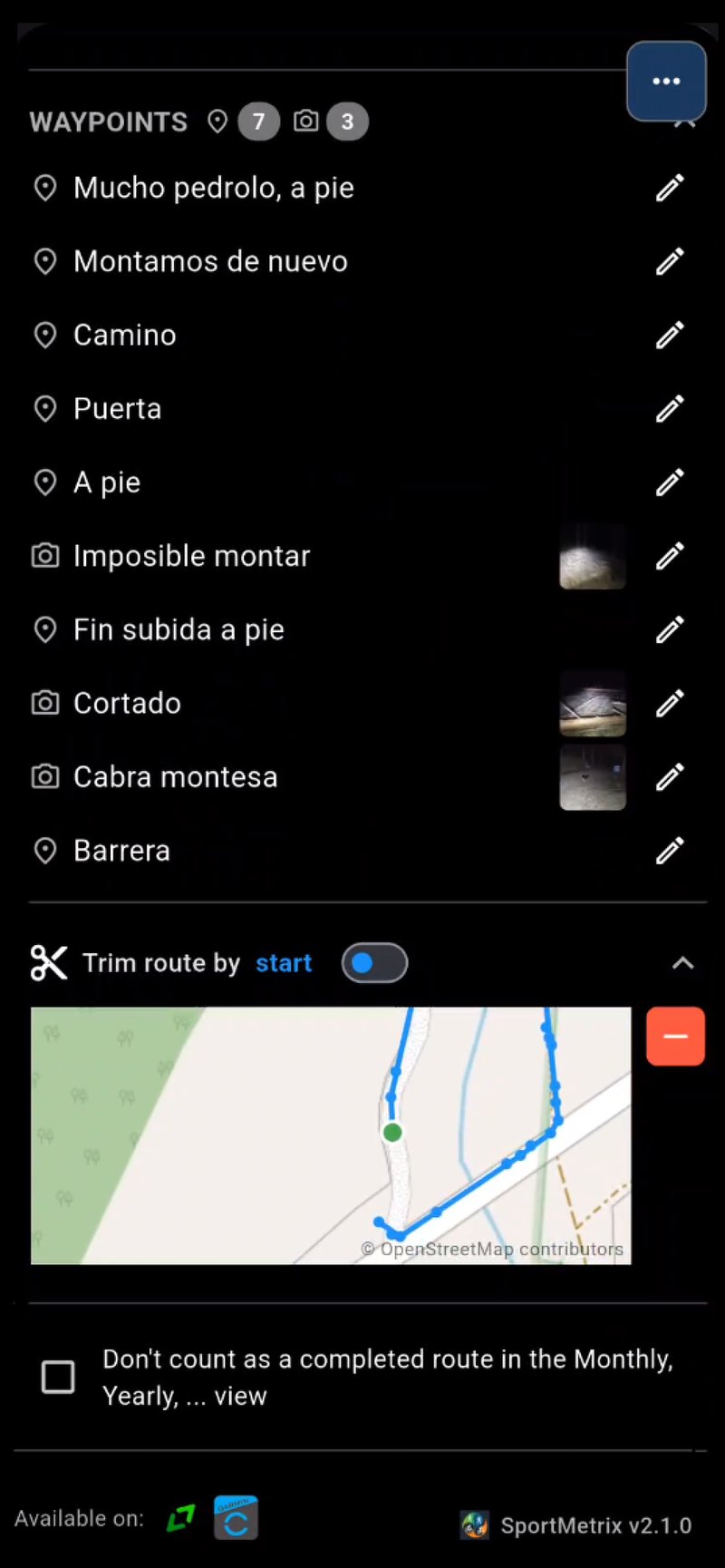
Trim points from the start or end of your routes and edit waypoints (add, modify or remove). Stats are automatically recalculated.
Move the map and a button appears next to the centre pointer to share that exact spot: copy it as a Google Maps, Apple Maps or Waze link and send it through any app. Tap a waypoint on your route to see its coordinates and share its position just as easily — perfect for reporting an incident or showing where you are.
05History
From yesterday’s route to how your year went. Each view answers a different question.
Tap a view to see it
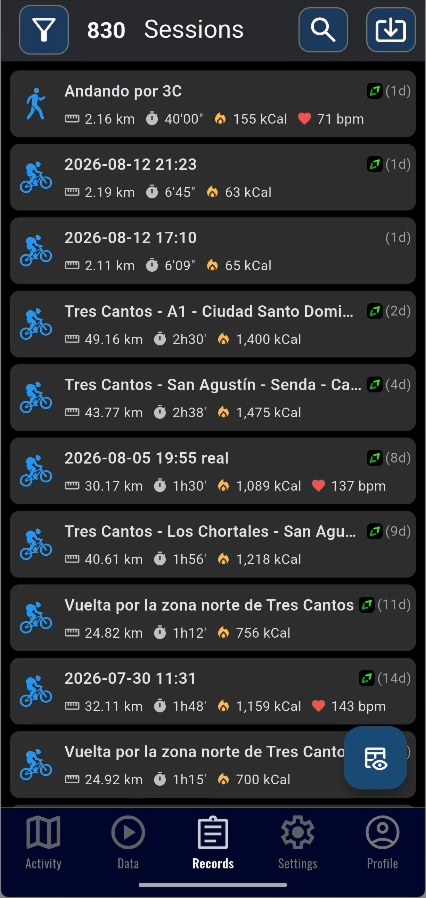
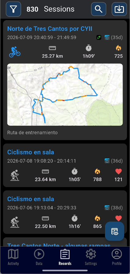
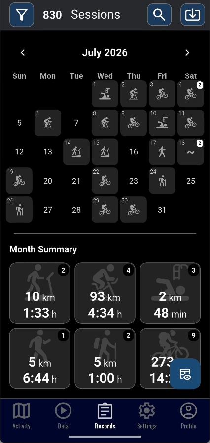
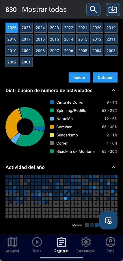
Find any route in your history by typing a few words: they match in any order and ignoring accents. The search also remembers your previous searches and suggests them when you open it.
Filter your history by sport type to quickly find your walks, bike rides or any other activity.
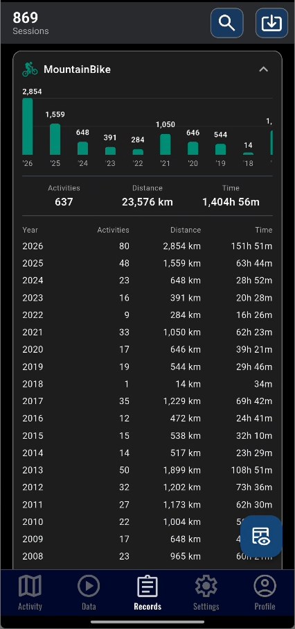
The history includes a Yearly view with your numbers for the year: daily activity map, monthly bars stacked by sport, distribution by sport and the records of the year. Plus a By-sport view to compare your evolution across years with synced charts.
06Analysis
Drag your finger over the chart to mark a stretch and see it highlighted on the route.
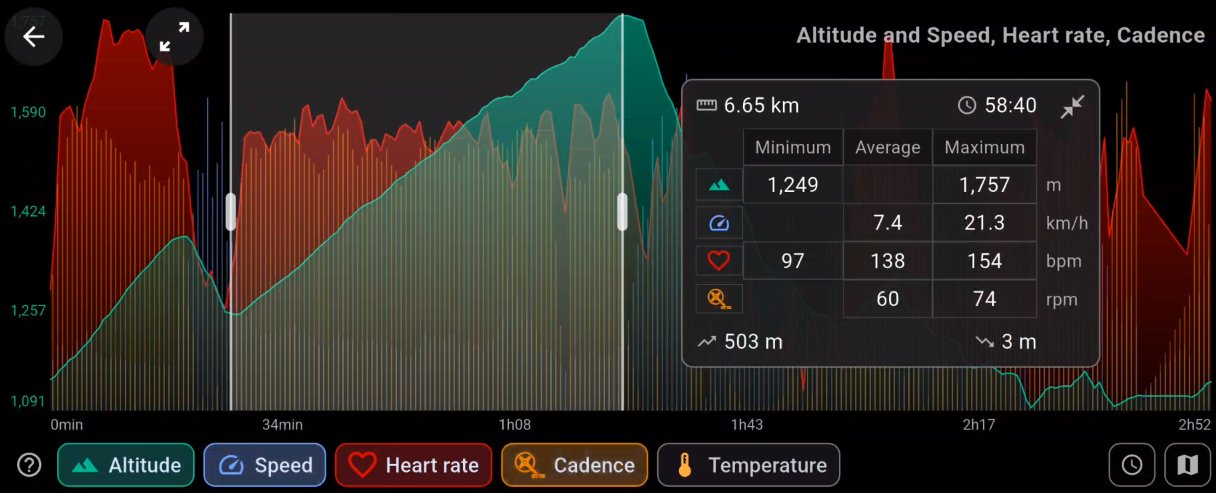
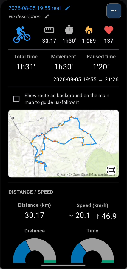
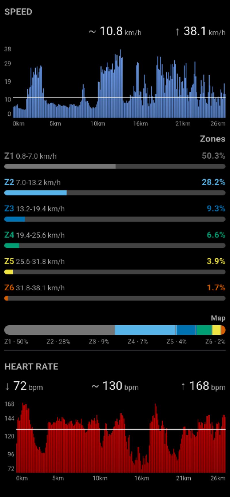
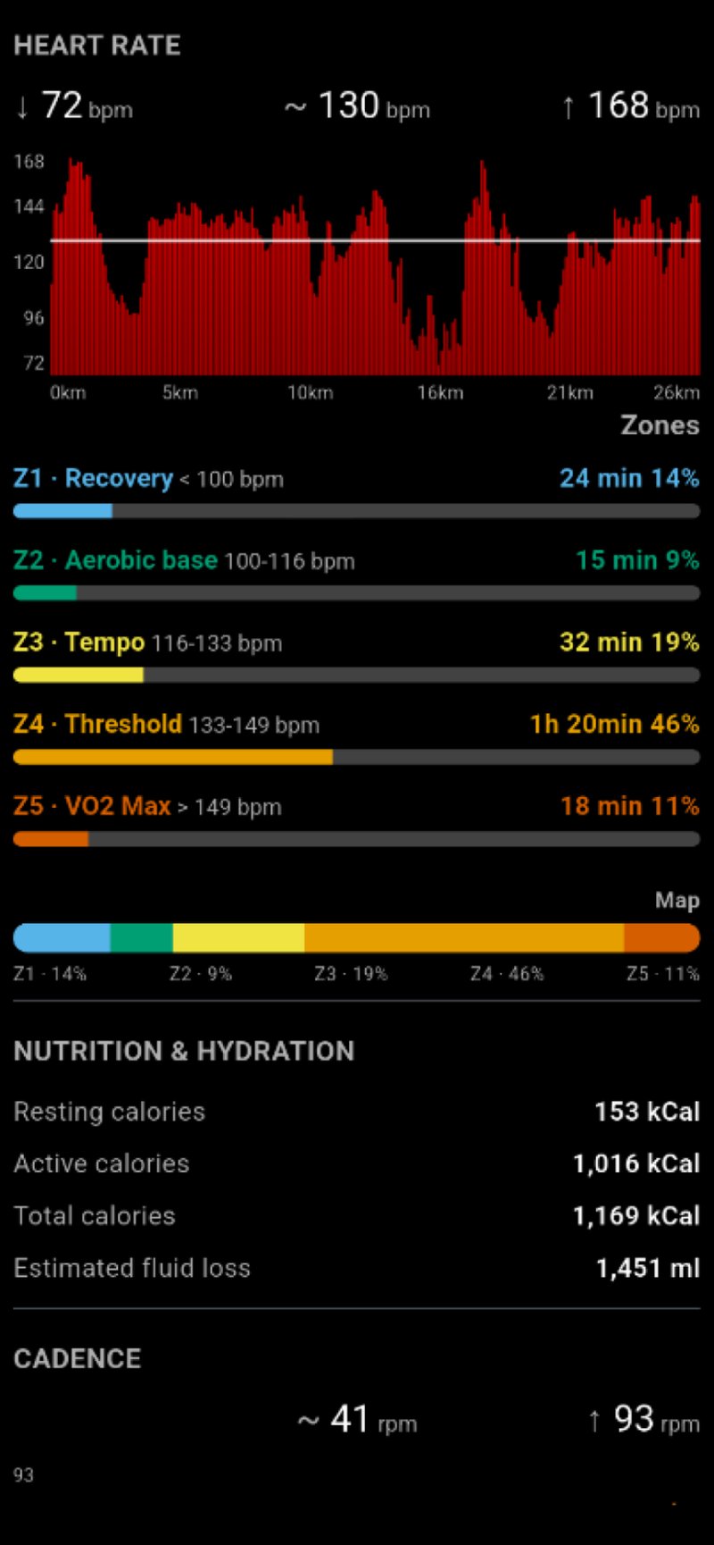
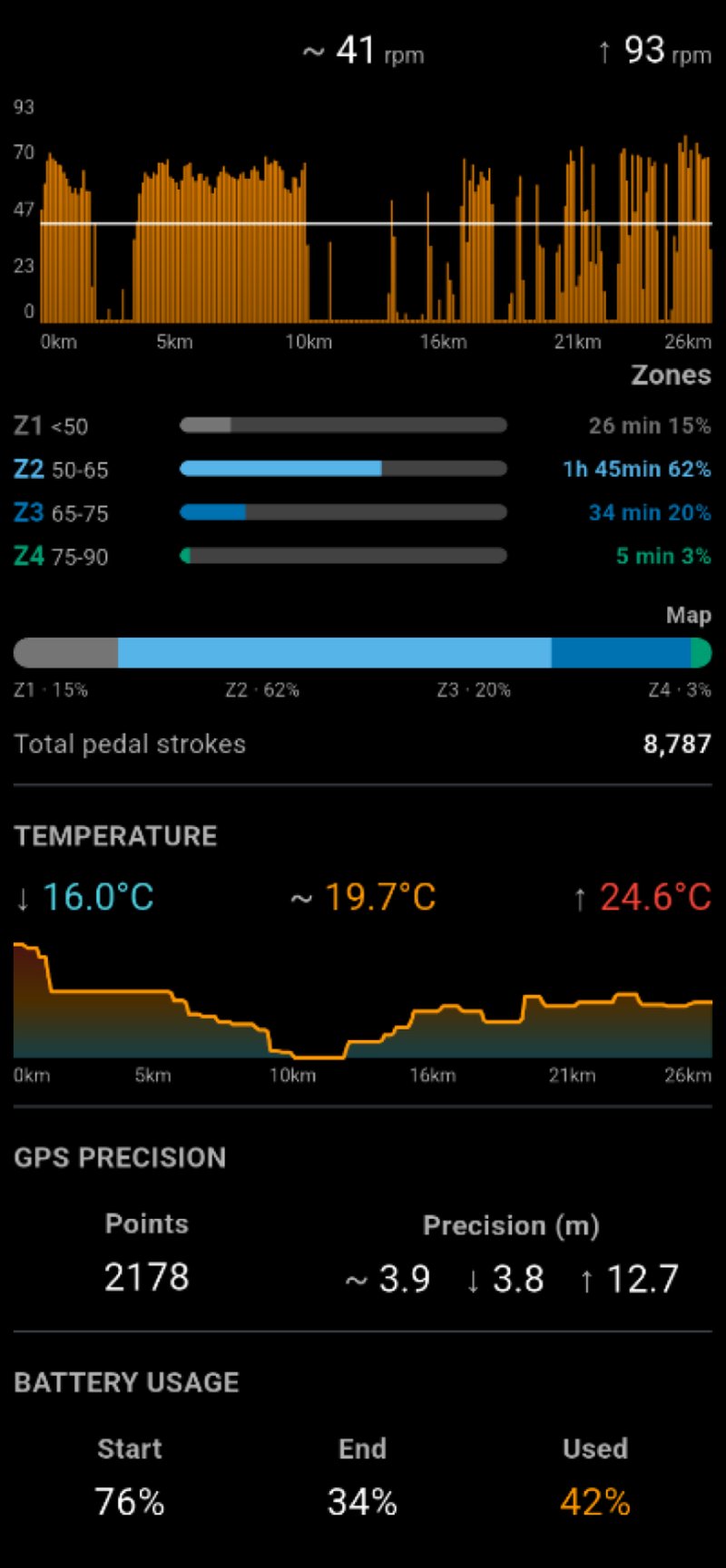
Altitude, speed or pace, heart rate, cadence and temperature, overlaid on the same chart. Pinch to zoom into a specific stretch and you get the real detail of your track, not a stretched image. The axis switches between distance and time from the chart itself — the time axis measures moving time, and the choice is remembered.
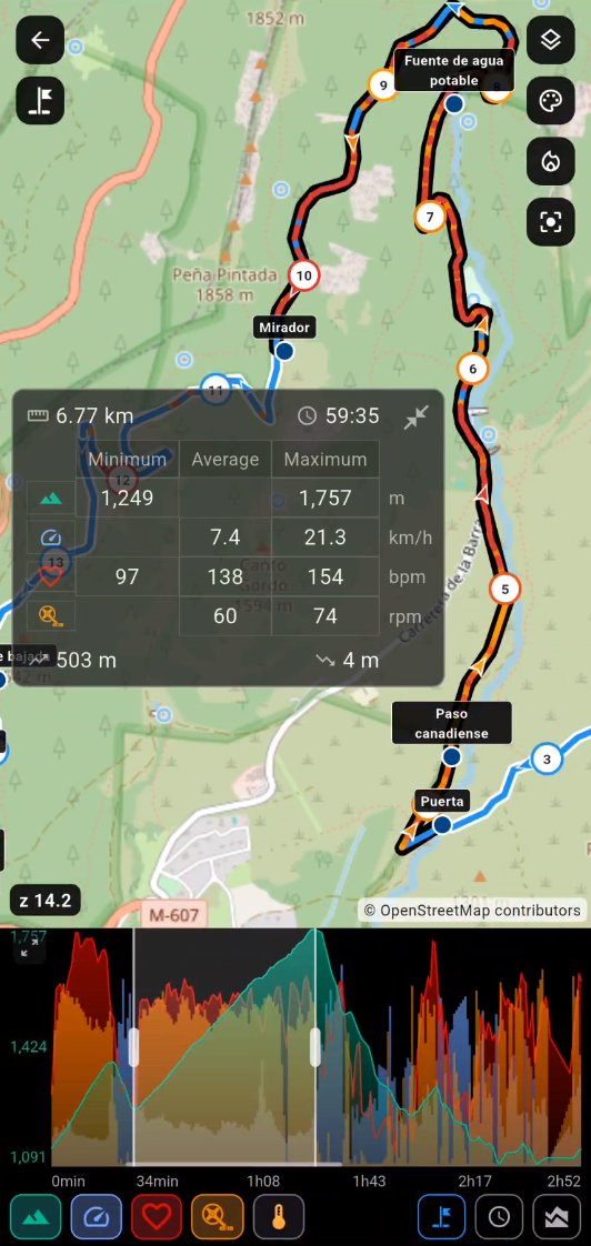
Drag over the chart and that stretch lights up on the map, which frames itself around it. A card shows its distance and time, the minimum, average and maximum of every active metric, and the elevation gained and lost.
One button hides the map and leaves the chart full-screen in landscape, with room to change each metric's colour and style. Whatever you were looking at survives the switch: the metrics, the zoom and the marked stretch stay exactly as they were.
Touch the chart and the map centres on that exact point of the route. Zoom in on the map and a bar under the chart tells you which part of the route you are looking at.
Elevations are corrected with high-resolution Copernicus DEM data, removing GPS inaccuracies. While you record too: the accumulated climb you see on the go is corrected every minute against the terrain model, so it matches the figure saved with the route.
Each workout detail breaks calories down into resting, active and total, and includes an indicative estimate of fluid loss through sweat, adjusted by temperature when data is available.
07Portals
Connect Strava, Garmin Connect and misrutas.net. SportMetrix brings your history in, sends your recordings out and keeps a single copy of each activity.
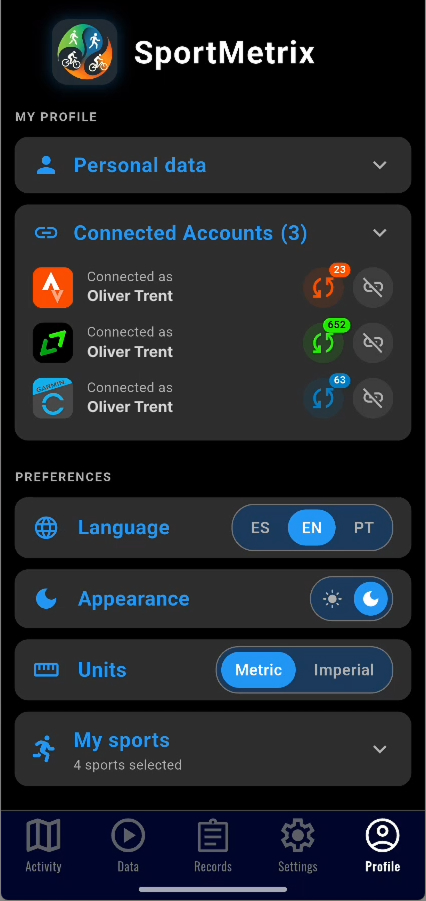
SportMetrix bridges your platforms: record a route in the app and take it to Strava, Garmin and MisRutas; or bring a route already uploaded to any of them into your phone and push it from there to the portal where it was missing. You end up with all your routes everywhere — your phone, Strava, Garmin Connect and misrutas.net — with no duplicates. Perfect as a backup of your history and to bring that neglected account up to date.
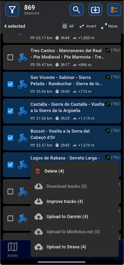
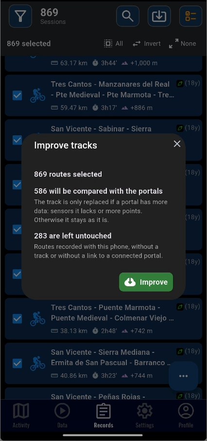
Tick several routes in your history at once and act on all of them: delete them, download their track or upload them to Strava, Garmin or MisRutas. Routes are processed one by one, you see which one is running and you can cancel anytime. If a route lives on several portals, the app downloads it from the one with the most data and checks that heart rate and cadence arrive; if they are missing, it tries the next one. And "Improve tracks" goes over the ones you had already downloaded in case another portal holds a more complete version.
Sync your activities with Strava. Import your Strava history, download the track of any activity with its heart rate, cadence and temperature, upload recorded tracks directly from the app and the activity description is also sent.
Link your Garmin Connect account with the official sign-in (two-step verification included): your Garmin activities appear in the app's history, you can download the full track of any of them on demand, upload workouts recorded with SportMetrix, and name and description sync both ways.
Link your misrutas.net account and keep everything in sync: your portal routes appear in the app's history, and you can upload workouts choosing public or private visibility and difficulty — with heart rate, cadence and temperature included, and the exact same numbers shown on both sides. Download the full track of any portal route to view it on the map, sync name and description both ways, and if an activity lives on several portals at once it shows up only once with all its badges.
08Share
A live link so someone can follow you, a six-digit code to pass a route on, or a file in the format the other person needs.
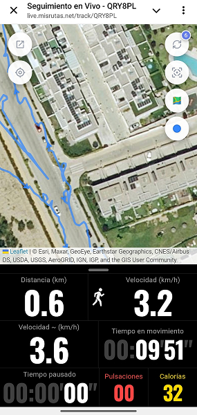
Share your real-time position with a link. Anyone with it can see your route, speed and data from any browser, no install needed. If you have routes loaded on the map, you can also upload them so viewers see the planned route as a reference. If you lose coverage, the map badge turns red and tapping it shows how many positions are pending and why; they are resent automatically once the signal is back. Automatically deleted after 6 hours.
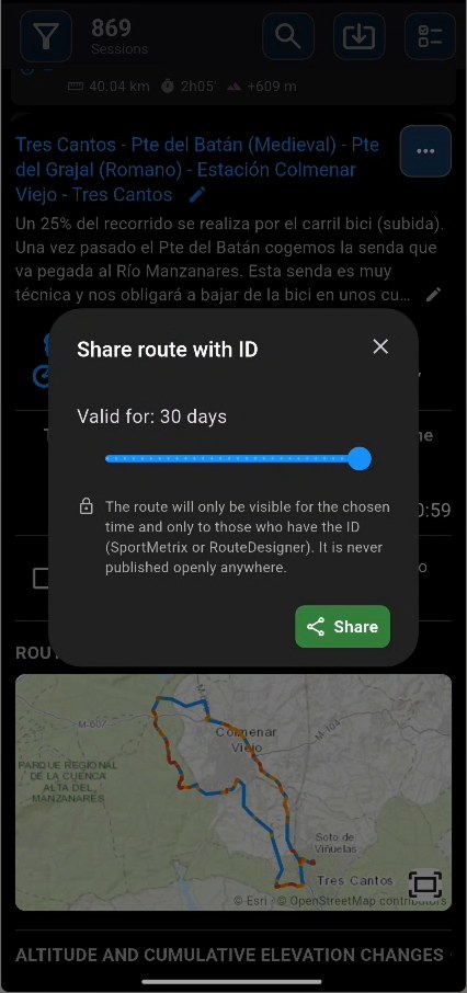
Share any of your routes with a 6-digit code, no files involved: choose how many days it stays available (1 to 30) and pass the code on however you like. Whoever gets it can import the route into SportMetrix or open it on design.misrutas.net. The route is only visible for the time you chose and only to whoever has the code — it is never published openly. You can stop sharing or generate a new code whenever you want.
Import a route by typing the 6-digit ID you were given, whether it comes from design.misrutas.net or from another SportMetrix user. The route downloads instantly with the name and the sport it was designed for already filled in (only your active sports are shown in case you want to change it) — just accept and it's saved to your history.
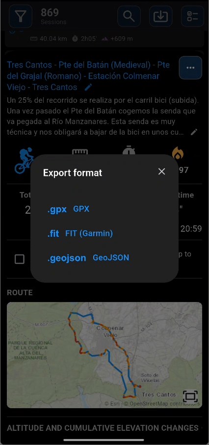
Import and export routes in GPX, FIT, TCX, KML/KMZ and GeoJSON — files from any portal work. Open them directly from WhatsApp, Telegram, Drive or any system app with "Open with SportMetrix". Any track can be used as a visual reference on the map, and you can stack several at once to choose your direction when a route has broken sections.
Demos
See how SportMetrix works with real examples.
More tools
The small things that, added up, make the difference.
Indoor and outdoor activities, each with its own metrics and sensor configuration. In your Profile, the sports list is organised in groups: on foot, cycling, water sports, gym and others.
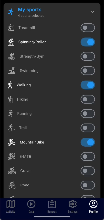
Switch sport instantly with the sport button built into the "Start activity" bar, on both the map and the Data screen, or by tapping the sport icon next to the stopwatch. Even mid-recording: long-press the icon and the whole ongoing activity switches to the new sport. From Profile → My sports you pick which sports appear. The start, pause and finish button is also on the map, so you can control the activity without changing screens.
Rearrange the data cards by dragging them, hide the ones you don't use and pick the colour of each value (also applied to the map panel). Each sport remembers its own layout and everything is included in your backup. If a sensor is not connected, its card shows an orange alert and you can connect right there, without going through Settings.
Connect your Bluetooth cadence sensor and see your RPM in real time. The workout detail shows your total pedal strokes and compact cadence zones in the style of the big fitness apps. Dual sensors (speed + cadence) around €12-17 per pair like Cycplus C3, CooSpo BK467, GeoId CS600 or Magene S3 work perfectly.
Connect your Bluetooth wheel speed sensor. Ideal for spinning and indoor trainer with accurate speed and distance data. The wheel is set up by measuring its circumference, with specific instructions for spinning bikes.
Turn on "Beep when out of range" and the app beeps if you exceed your estimated maximum heart rate for your age and sex, with nothing to configure. If you prefer, set a custom range and the beep sounds periodically while you're outside it, above or below. Perfect for staying in your target zone without looking at the screen.
Subtle icons confirming at a glance that live sharing is sending and that your heart-rate and cadence sensors are receiving data. If your heart rate enters the alert zone, the heart in the values panel turns red and pulses in time with your heartbeat, so you notice without taking your eyes off the map.
Mark segments during your activity with a single tap. Each segment records distance, time and average speed. Perfect for tracking splits in races or separating effort zones.
Dynamic calculation based on MET, adjusted by weight, activity, speed and heart rate. Works with or without a heart rate monitor.
Interactive charts for heart rate, speed, cadence, temperature and elevation profile. Training zones with time distribution. If the temperature was recorded wrongly, long-press its chart to re-download the data for the whole route and redraw it.
Open any finished route and explore it with zoom and rotation: track coloured by slope, speed or elevation, direction arrows, distance markers, six map types, the popular-routes heatmap and full waypoint management right on the map (one button hides them to see the bare track). Below, a chart linked to the map: tap the track or drag your finger along the chart and you see the same point in both places; mark a stretch and get its distance, time, climb and average gradient.
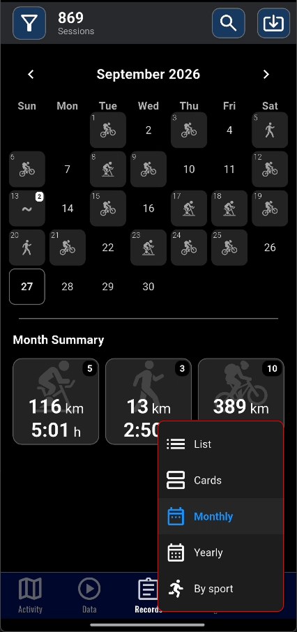
View activities in list or monthly calendar with aggregated stats by sport. Filter by activity type with one tap. Routes with elevation gain show it in the list, and age is shown in the readable unit (years, months, days or hours).
Redesigned card view in the history and a detail panel with summary, start and end date of each route. Clearer information at a glance.
Hide the map to focus only on your stats. Light version for daytime, dark version for night rides to preserve night vision without glare. The dark one uses pure black, which saves battery on OLED screens.
Add reviews and comments to your routes to record sensations, terrain difficulty or notes that help you when you review them later. Long descriptions are collapsed to four lines, with the edit pencil always at hand; double-tap to expand or collapse them.
If the sport doesn't record speed (e.g.: treadmill without sensor), you can enter the distance manually when finishing to complete the activity.
See how much battery each activity consumed. Useful to plan long routes and adjust GPS mode.
Floating button to save your stats at any time directly to your gallery.
Audio countdown before the activity starts so you can get ready without looking at the screen.
Switch between kilometres and miles anytime. Auto-detects your region and converts distance, speed, elevation and pace.
Switch between dark and light theme from your profile. Each optimized for different conditions.
Full interface in English, Spanish and Portuguese. Automatic system language detection.
Create backups and restore whenever you want. Automatic detection of previous backups when reinstalling.
If permissions or your details (age, weight, height) are missing, the app tells you at startup and takes you to the right screen with one tap. Your details are used for calories and zones, and they never leave your device. And when location is missing, a clear message over the map tells you what to do, with a direct button to the system settings.
A discreet banner in your profile warns you when a new version is published on Google Play, with direct access to update.
No registration, no analytics, no ads. All your data stays on your device. No cloud, no servers storing your routes.
For developers
Origin
More than 25 years using GPS devices, apps and route portals. Hundreds of kilometres lost carrying the bike on my back, crossing rivers, jumping fences, running from cows, dogs and even geese. Downloading orthophoto tiles and stitching them together by hand to plan routes when Google didn't even have maps… A few months ago I decided to build the app with the mix of features I craved and no one offered. After months of using it, the GPS ended up in a drawer — more precision, more data, more useful. What's more, it motivates me to keep doing sport. It started as a personal project; the result convinced me to share it.
Get started
Android & iOS · GPS · Bluetooth optional
Compatible with Android 7.0 or higher and iOS.